
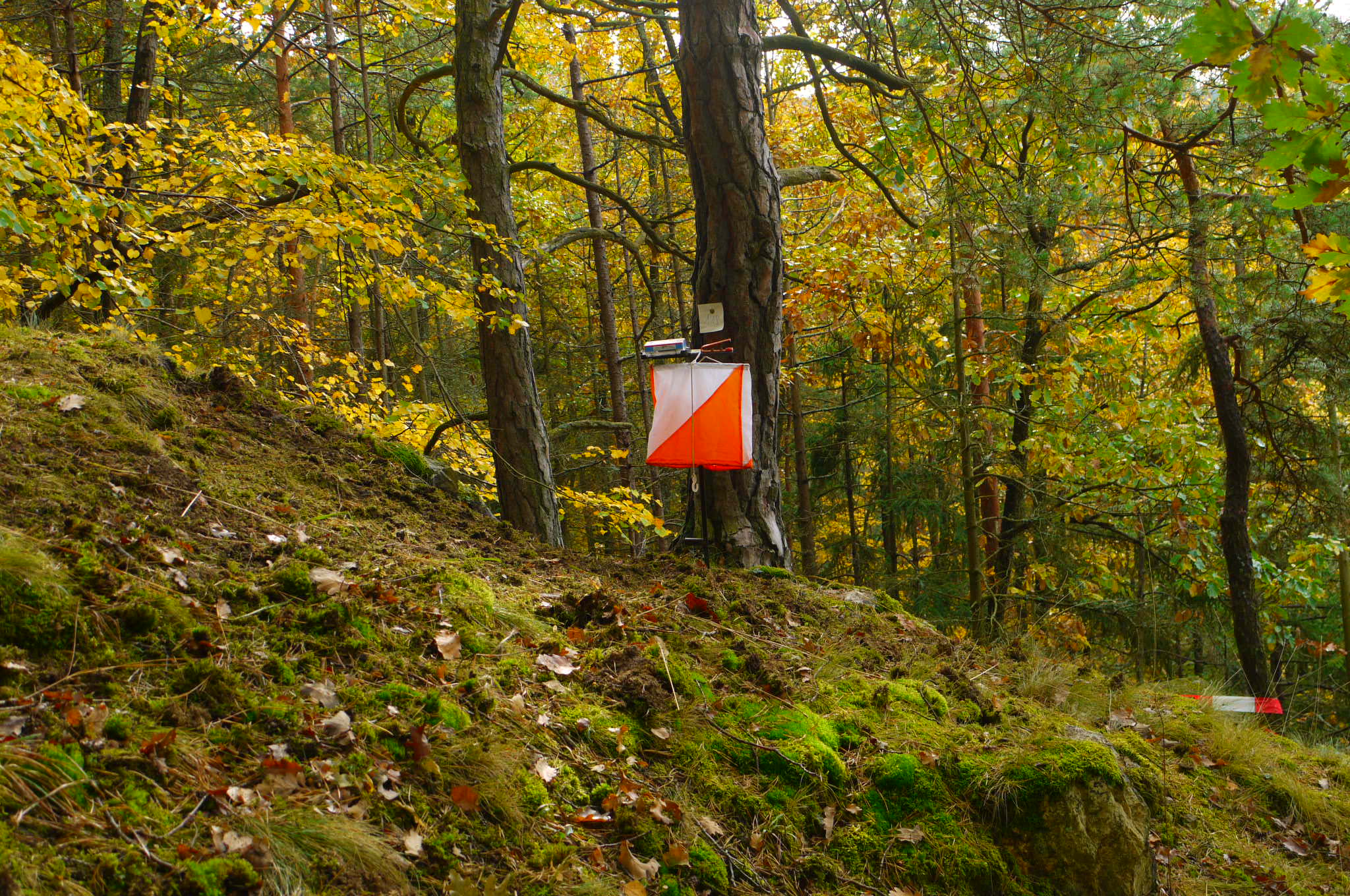
There is an outdoor sport that makes a person stop, look around and decide what to do next. It is not quite hiking, not quite trail running and not a scavenger hunt, although it borrows the best parts of all three. Orienteering asks participants to find marked points in the landscape using a specialized map, and on Saturday, November 7, the Austin Orienteering Club will offer that challenge at Parrie Haynes Ranch near Killeen.
What happens at an orienteering event?
Instead of following one established course from start to finish, participants navigate from one control point to another. Each control has a location marked on the course map, but finding an efficient route is up to the competitor. Choosing a safe path, recognizing a bend in a trail and noticing how a slope meets a clearing become part of the competition.
That makes the sport unusually accessible to different styles of participants. Some people move quickly and measure the outing against a clock. Others walk deliberately, discuss the map and learn the landscape. The sport rewards accuracy. A confident wrong turn can cost more time than stopping for a thoughtful decision.
It also provides a genuine skill-building experience. A runner may already know how to manage pace and fatigue but have little practice interpreting terrain. A casual hiker may be excellent at recognizing natural landmarks but unfamiliar with an orienteering map’s symbols. Both can learn something useful in the same session.
The official November 7 plan
The Austin Orienteering Club lists Parrie Haynes Ranch at 13816 Maxdale Road, Killeen, for its November 7 event. Check-in is posted for 9–10 a.m., with a beginner class from 9:15–9:45 a.m. First starts are scheduled for 10 a.m., and the organizer’s event information says the courses close at 2 p.m.
The beginner class is an especially good reason to arrive on time. Arriving just before a first start and hoping to learn the sport through trial and error may produce a frustrating outing. Instruction provides an introduction to how the map communicates distance, direction and terrain, giving newcomers a vocabulary before they head out.
The event lists a three-hour time limit for courses, which is different from the overall course-close time. Participants should read the precise instructions for their chosen category. If uncertain about how to return before closing, ask during check-in instead of making assumptions in the field.
Choosing a course is the first navigation decision
The published course menu ranges from White at about 2–3 kilometers and Yellow at about 3–5 kilometers through Orange, Brown and Red choices with more challenging navigation. Red is listed at 6–10 kilometers. Distance alone does not tell the whole story: difficulty also reflects the complexity of the navigational decisions.
For a first outing, the easiest suitable course is usually the smartest choice. It allows someone to learn how control points look, how to read the next feature on a map and how to recover from a mistake. A newcomer who completes a beginner course confidently often learns more than one who spends an afternoon lost on an ambitious route.
People with hiking experience should not automatically skip beginner options. A marked trail does not require the same repeated decisions as an orienteering route. The participant has to interpret a detailed map, recognize the shape of the terrain and choose when to use a trail versus a more direct line. It takes practice to do that efficiently.
What to bring to Parrie Haynes
Wear shoes with grip suitable for natural surfaces, clothing comfortable for moving through outdoor terrain and enough water for the expected effort. A small, secure pack or pockets can help carry essentials while keeping both hands free for handling the map. A basic compass may be useful, but participants should review the organizer’s instructions for what is supplied and what is allowed.
Avoid treating navigation like a phone-only activity. Orienteering events often use detailed printed maps created for the course, and the experience is built around interpreting those details. A charged phone is still useful for safety and communication where service is available, but it should not replace learning the course’s official method of navigation.
Bring an unhurried mindset. The temptation when unsure is to keep moving, assuming the next turn will make everything clear. Instead, stop, locate a feature you recognize, orient the map and make a deliberate plan. That habit works both in the event and on ordinary outdoor outings.
The entry fees and deadlines matter
The organizer lists adult entry at $15 and junior entry at $10, with a $2 member discount and a $5 SPORTident electronic card rental. It says participants need the electronic card and can rent one if they do not own it. The registration page also specifies that payment must be completed online, and it lists a cutoff of Wednesday, November 4, at 6 p.m.
Those details matter more than generic advice to ‘show up early.’ If entry requires advance payment, walking into the venue on Saturday without a valid registration may not work. Check the official page for any updates or remaining space, and read the instructions for individuals, teams and school groups carefully.
The organizer identifies Dennis Wilkinson as the event director and course setter. That combination of preparation and volunteer work is worth recognizing. Participants experience a route for a few hours; someone else has invested time designing controls, planning safety and ensuring that beginners and experienced navigators can share the same terrain.
How to avoid the three classic beginner mistakes
The first mistake is assuming the shortest line on the map is always the easiest. Thick vegetation, uneven ground or a difficult crossing can make a longer route along a trail more efficient. Good navigation is partly about comparing risk with distance, not simply walking toward a point as directly as possible.
The second is moving before orienting the map. At every significant junction, pause long enough to confirm which direction the trail runs and which landmarks should appear next. The third is refusing to admit a route choice may have been wrong. If the expected control or trail feature does not appear, retrace to a known position rather than building a second guess on top of the first.
Partners can make the learning process easier by explaining their decisions aloud. One person reads the map while the other looks for visible landmarks, and both agree on the next check point. For children, that collaboration can turn a difficult moment into a small puzzle the group solves together.
Why Killeen deserves this sort of coverage
Central Texas has many stories that never fit into a Friday football headline. A sports event at Parrie Haynes connects outdoor recreation, youth participation, problem solving and an organized club in a way that deserves independent attention. It also gives families around Killeen, Temple and Waco something concrete to try without planning a major trip.
This event is not a replacement for hiking; it is another reason to explore outdoor space carefully. People who discover that they enjoy navigation might want to return for more advanced courses or try similar events elsewhere in Texas. Beginning with an approachable route is how many lasting hobbies start.
For the latest course details and registration, visit the Austin Orienteering Club event information. Find more local activities through Thunderfoot’s Texas Event Finder. This preview is based on organizer information checked November 1, 2026; course and entry details may change.